Using Google Maps to calculate the distance between two points is simple and this tutorial explains how.
The tool that Google Maps uses to calculate distance does not to work for long distances, such as those that are more than 1,000 km. I will explain the reasons for this first. If that does not interest you, you can skip ahead to the instructions.
Great Circles
Google Maps calculates the distance between two points, but it does not take into consideration the curvature of the earth. Because of this, its calculation is incorrect for long distances, because a straight line drawn on a two-dimensional map is not a straight line on a three-dimensional surface such as the earth. If you follow the straight line shown on Google maps, then you are actually taking a longer route when you travel around the earth. That is only an issue for great distances as the curvature of the earth is not great over shorter distances. Calculating the distance from your house to the airport should be fine.
Have you ever wondered why airplanes leaving Kennedy airport in New York head northeast when they fly to Italy or Spain instead of flying due east. If you look at them on a map, Spain and Italy are due east of New York. But flying east from New York to Spain is taking the long way around. This is because the earth is a ball. The shortest distance between two points on the earth is called a great circle, which is a curve.
You could see this if you could get into a high flying airplane and go into a low orbit around the planet. If looked down you would see that a line running from New York to Barcelona is a curve, but a line further north is straight. Another way to think of this is to imagine the earth as a balloon. Connect New York and Barcelona by a string and pull the string tight. The string will rise up the balloon forming a curve that is the shortest distance between the two points. Rotate the balloon down until you are looking at Iceland and hold it out at arms length. Now you will see a straight line. So that curve is a straight line when viewed from above.
How to Calculate Distance With Google Maps
Calculating distance with Google Maps is as easy as clicking on two points or more. However, you have to switch to Classic Google Maps to enable the tool to do that.
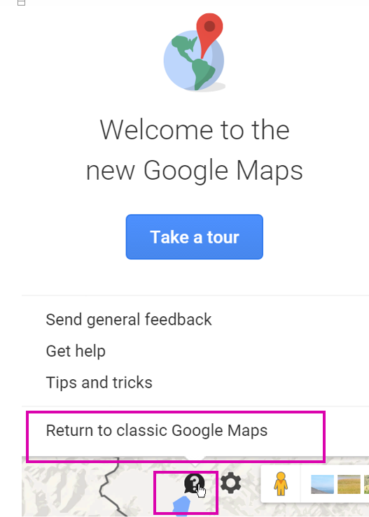
1.When you log into Google Maps and at the bottom right you see a question mark for help, then you are in the new version of Google Maps. Click the question mark, and then select Return to Classic Google Maps as shown below.
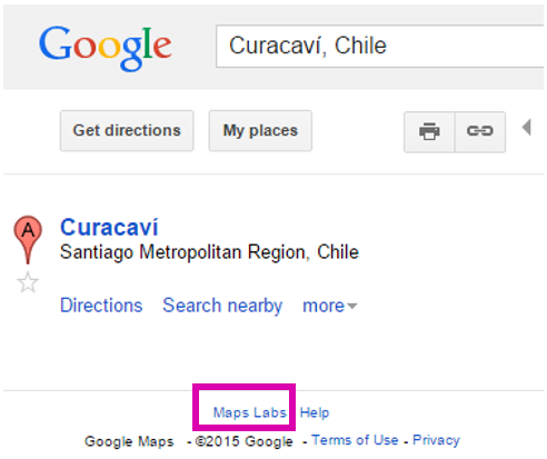
2.Now, click Maps Labs.
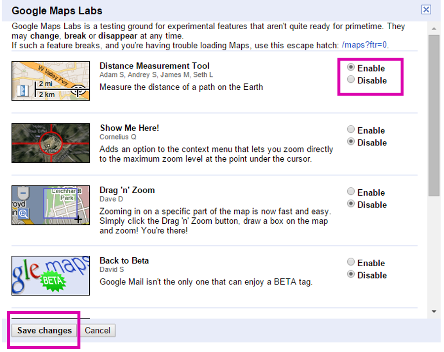
3.Enable the Distance Measurement Tool, and press Save Changes.
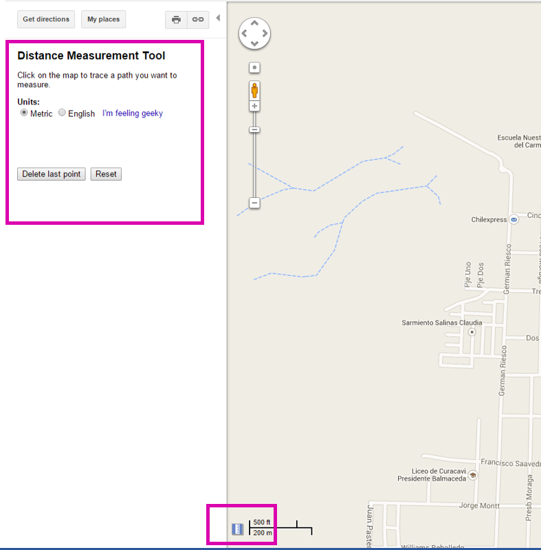
4.Click the measuring icon at the bottom. As you can see the distance measurement tool pops up on the left. Pick Metric or English units.
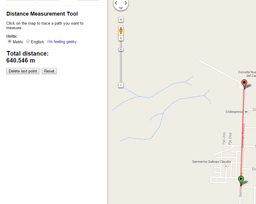
5.Now, click a starting point and then an ending point. Google Maps will show you the distance.
You can click another point if you want to keep going, as in a calculating route with different stops in between. Maybe you want to calculate the distance around a square, like your house lot, to see how many hectares you own.
6.If you click the ruler icon again, it gives you a chance to switch back to the new Google Maps.